


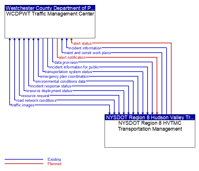
alert notification (Planned) Selected Comm Solution
Notification of a major emergency such as a natural or man-made disaster, civil emergency, or child abduction for distribution to the public. The flow identifies the alert originator, the nature of the emergency, the geographic area affected by the emergency, the effective time period, and information and instructions necessary for the public to respond to the alert. This flow may also identify specific information that should not be released to the public.
alert status (Planned) Selected Comm Solution
Information indicating the current status of the emergency alert including identification of the traveler and driver information systems that are being used to provide the alert.
data provision (Existing)
Data provision provides the source material for a publish-subscribe or query-retrieval data distribution scheme. This is the 1 of the 1:N data distribution architecture. This flow is a super-flow; it does not define data elements but is inclusive of any flow implemented using publish-subscribe or query-retrieval methods.
emergency plan coordination (Existing) Selected Comm Solution
Information that supports coordination of emergency management plans, continuity of operations plans, emergency response and recovery plans, evacuation plans, and other emergency plans between agencies. This includes general plans that are coordinated prior to an incident and shorter duration tactical plans that are prepared during an incident.
environmental conditions data (Existing) Selected Comm Solution
Current road conditions (e.g., surface temperature, subsurface temperature, moisture, icing, treatment status) and surface weather conditions (e.g., air temperature, wind speed, precipitation, visibility) as measured and reported by fixed and/or mobile environmental sensors and aggregated by the data collector. Attributes relating to the data collection (and aggregation) are also included.
incident information (Existing) Selected Comm Solution
Notification of existence of incident and expected severity, location, time and nature of incident. As additional information is gathered and the incident evolves, updated incident information is provided. Incidents include any event that impacts transportation system operation ranging from routine incidents (e.g., disabled vehicle at the side of the road) through large-scale natural or human-caused disasters that involve loss of life, injuries, extensive property damage, and multi-jurisdictional response. This also includes special events, closures, and other planned events that may impact the transportation system.
incident information for public (Existing) Selected Comm Solution
Report of current desensitized incident information prepared for public dissemination.
incident response status (Existing) Selected Comm Solution
Status of the current incident response including a summary of incident status and its impact on the transportation system, traffic management strategies implemented at the site (e.g., closures, diversions, traffic signal control overrides), and current and planned response activities.
maint and constr work plans (Existing) Selected Comm Solution
Future construction and maintenance work schedules and activities including anticipated closures with anticipated impact to the roadway, alternate routes, anticipated delays, closure times, and durations.
resource deployment status (Existing) Selected Comm Solution
Status of resource deployment identifying the resources (vehicles, equipment, materials, and personnel) available and their current status. General resource inventory information and specific status of deployed resources may be included.
resource request (Existing) Selected Comm Solution
A request for resources to implement special traffic control measures, assist in clean up, verify an incident, etc. The request may poll for resource availability or request pre-staging, staging, or immediate deployment of resources. Resources may be explicitly requested or a service may be requested and the specific resource deployment may be determined by the responding agency.
road network conditions (Existing) Selected Comm Solution
Current and forecasted traffic information, road and weather conditions, and other road network status. Either raw data, processed data, or some combination of both may be provided by this flow. Information on diversions and alternate routes, closures, and special traffic restrictions (lane/shoulder use, weight restrictions, width restrictions, HOV requirements) in effect is included.
traffic images (Existing)
High fidelity, real-time traffic images suitable for surveillance monitoring by the operator or for use in machine vision applications. This flow includes the images. Meta data that describes the images is contained in another flow.
transportation system status (Existing) Selected Comm Solution
Current status and condition of transportation infrastructure (e.g., tunnels, bridges, interchanges, TMC offices, maintenance facilities). In case of disaster or major incident, this flow provides an assessment of damage sustained by the surface transportation system including location and extent of the damage, estimate of remaining capacity and necessary restrictions, and time frame for repair and recovery.

All rights reserved. © 2020 New York State Department of Transportation